
ESRGC Expands Services with New LiDAR Products
SALISBURY, MD---Salisbury University’s Eastern Shore Regional GIS Cooperative’s (ESRGC’s) nearly 20 years of service have established the co-op as a leading provider of geographic information system (GIS) services and web applications across Maryland.
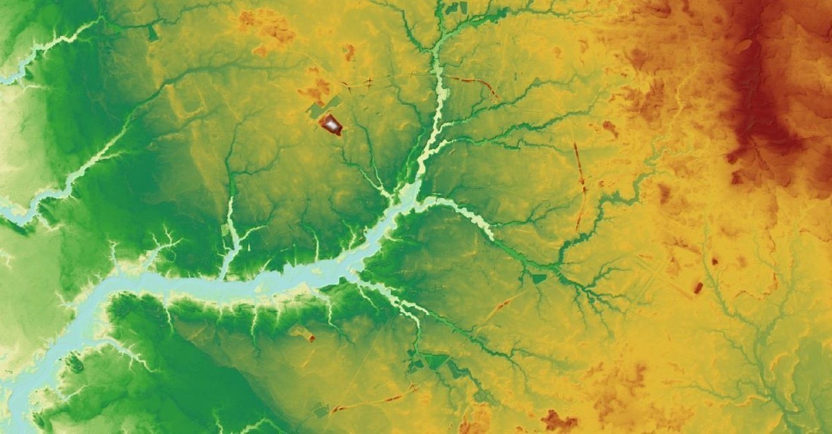
Now, the organization boasts even more advanced services, expanding its offerings to include the use of cutting-edge LiDAR derivative products, to elevate its projects for years to come.
The Tri-County Council of the Lower Eastern Shore enabled the ESRGC to add these products through GIS Circuit Rider funds.
“We are so excited to be able to offer new data to our partners that aren’t available anywhere else in the state,” said Mary Buffington, ESRGC project manager. “Thanks to the support from our regional councils, we are able to enhance the services for our collective partnerships without the strain of new technology, funding and personnel time needed for entities to create these products themselves. ESRGC can continue to support organizations with even more GIS needs than ever before, which allows us and them to use data we haven’t been able to explore yet. This is a win for everyone involved with so many benefits to come.”
The Upper-Shore, Mid-Shore and Tri-County regional councils provide base funding for the GIS Circuit Rider through Rural Maryland Council by Rural Maryland Prosperity Investment Funds (RMPIFF). Responding to the need for assistance with GIS-related tasks, the GIS Circuit Rider provides specialized solutions to a range of GIS needs for the region; from assisting with comprehensive plan nuisance flood mapping, historic preservation commission database design and implementation planning, data manipulation and recovery assistance, and GIS workflow consultation.
Previous Circuit Rider projects from the ESRGC include a custom web map application for Somerset County, City of Salisbury Public Art Walking Tour web map application for the Salisbury Arts and Entertainment District, and data development including geocoding emergency medical service calls and digitizing building footprints for Caroline and Somerset counties.
“These new LiDAR products allow the ESRGC to be pioneers in the state for analyzing this data from products that have either never been available before, or have small scales of data that have yet to be broadened for a larger scope,” said Logan Hall, senior GIS analyst. “Our products need to be responsive, fast and the highest quality we can provide. This elevation of our services to our partners highlights ESRGC’s capacity and the level and depth of work we can provide here on the Eastern Shore that lends our own spin and creative approaches. We provide competitive services comparable to much bigger regions while continuing to foster comprehensive local relationships with our councils, project partners and SU.”
LiDAR, or Light Detection and Ranging, is an active remote sensing technology that uses light in the form of a pulsed laser to measure distance. Light pulses, combined with other data points generated by the system, create accurate 3-D information about an object in relation to its environment. LiDAR is unparalleled in depth and dimension for finding the distance between objects and does so faster than RADAR or cameras. ESRGC LiDAR products, such as contour and shaded relief maps, can be found at its services server.
For more information visit the ESRGC’s website.
Learn more about how SU students and faculty are exploring opportunities for greatness and making tomorrow theirs at the SU website.